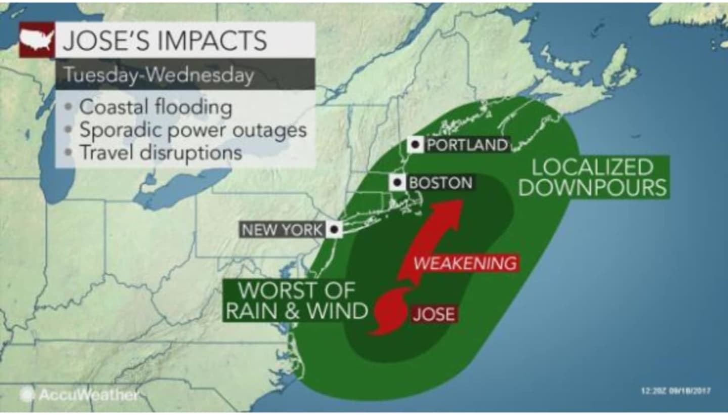
Winds could increase out of the northeast on Tuesday morning, and coastal Connecticut locations can expect winds of 20 to 25 mph, with gusts of 35 to 40 mph during the day Tuesday through Wednesday. There could be some immediate coastline flooding, but it should not be major.
The Norwalk Fire Department is warning that high winds can cause downed trees and power lines, flying debris and building collapses, which may lead to power outages, transportation disruptions, damage to buildings and vehicles, and injury or death.
Residents should make sure their property is secure in advance of the storm, and remove any dead trees or overhanging branches near structures, as well as loose roofing material and objects in yards, patios, roofs or balconies that could blow away.
If a high wind warning is issued:
- Take shelter and tune in to local weather forecasts and bulletins issued by the National Weather Service
- Shutter windows securely and brace outside doors
- Bring in unsecured objects from patios and balconies and secure outdoor objects such as decorations, lawn furniture or garbage cans that could blow away and cause damage or injury
The safest place to stay during high winds is indoors. Postpone outdoor activities if a wind advisory or high wind warning has been issued.
- Watch for flying debris. Tree limbs may break and street signs may become loose during strong wind gusts. Keep an eye toward nearby balconies for loose objects that may fall
- Take cover next door to a building or under a shelter. Stand clear of roadways or train tracks, as a gust may blow you into the path of an oncoming vehicle
- Use handrails where available on outdoor walkways, and avoid other elevated areas such as roofs without adequate railing
- Avoid anything that may be touching downed lines, including vehicles or tree branches. Puddles and even wet ground can conduct electricity in some cases. Warn others to stay away
- Do not touch anyone who has been shocked who may be in direct or indirect contact with a power line. You may become a second victim. Get medical attention as quickly as possible by calling 911
When driving, keep both hands on the wheel and slow down. Watch for objects blowing across the roadway and into your path
- Keep a safe distance from cars in adjacent lanes as strong gusts could push a car outside its lane of travel
- Take extra care in a high-profile vehicle such as a truck, van, SUV, or when towing a trailer, as these are more prone to be pushed or even flipped by high wind gusts
- If winds are severe enough to prevent safe driving, get onto the shoulder of the road and stop, making sure you are away from trees or other tall objects that could fall onto your vehicle. Stay in the car and turn on the hazard lights until the wind subsides
- If a line falls on your car, stay inside your vehicle. Take care not to touch any o the metal frame of your vehicle. Honk your horn, roll down the window and warn anyone who may approach of the danger. Ask someone to call the police. Do not exit the car until help arrives, unless it catches on fire. To exit, open the door, but do not step out. Jump to safe ground and get away quickly, without touching any o the metal portions of the car's exterior.
Click here to follow Daily Voice Darien and receive free news updates.